
2The Yucatan, Limestone and Cenotes
The Yucatan Peninsula’s bedrock is mostly soluble limestone. The limestone eventually dissolves once exposed to seeping water for a long time. In the resulting karstic terrain, the permeable bedrock doesn’t permit water to collect above ground as lakes or rivers.
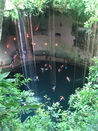
Alternatively, rainwater filters underground through the porous rock and gathers subsurface where the erosion process continues. Sometimes the bedrock weakens and collapses to expose a cave or a cenote. Mind you, there are different kinds of cenotes too.
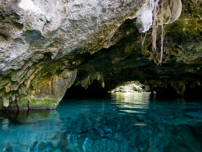
Some cenotes are shallow and wide, while others are deep shafts filled with water with totally vertical walls, while others are shallow but wide. Still, other cenotes are partially open with some of the water out of sight in a hidden cavern. There are also cavernous cenotes that are only accessible via tunnels or openings in the ceiling.
They are even more complicated underground. Cenotes allow explorers to access prodigious networks of relatively unexplored systems of caves. Along the Caribbean coast they broaden horizontally, while in northwest Yucatan, they’re usually on a vertical plane.
If you’re in Tulum, visit the Grand Cenote. From there you can access the well-known Sistema Sac Actun. It is the world’s second-largest cave system stretching out 335 kilometers. You can find two of the five officially “longest cave systems” in the state of Quintana Roo.
Modern-day researchers have utilized technology to prove a connection between cenotes and the fate of the dinosaurs. Aerial mapping indicated there is a circular to the jungle cenotes. This ring actually marks the rim of a crater caused by a massive meteorite. It dates back 66 million years, somewhere between the Cretaceous and Paleogene Ages.
(Continued on next page)


Poco
OK